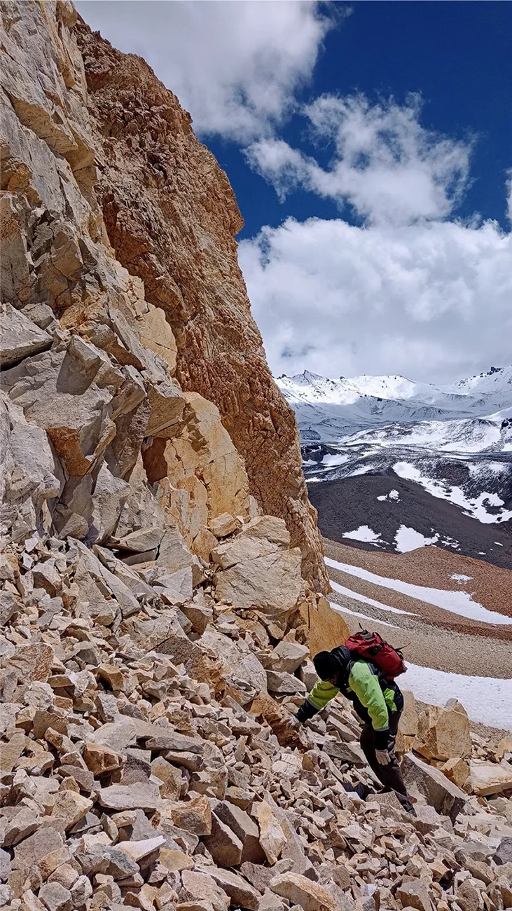
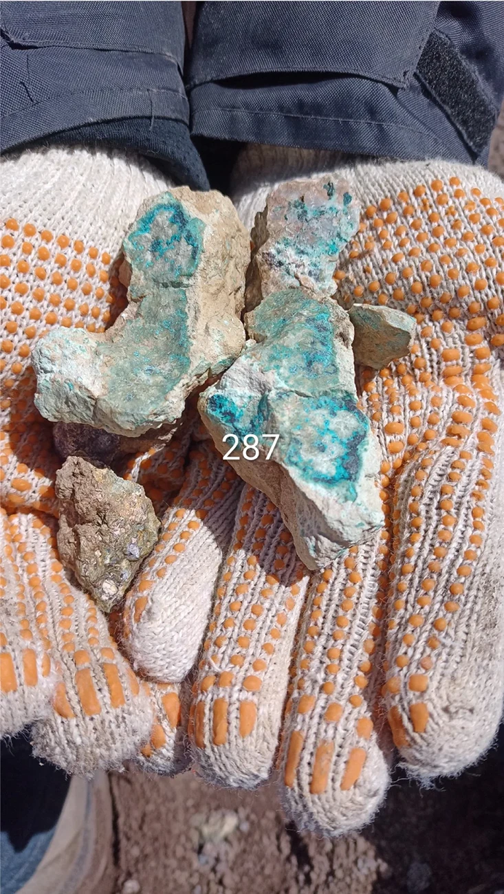
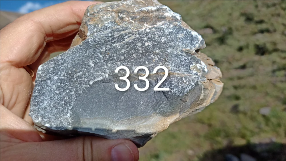
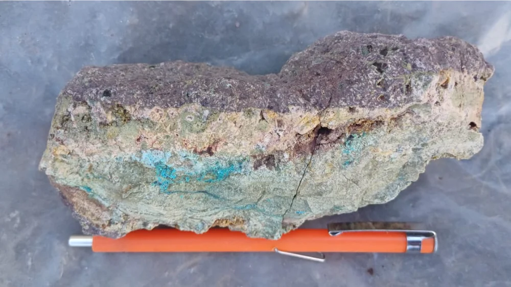
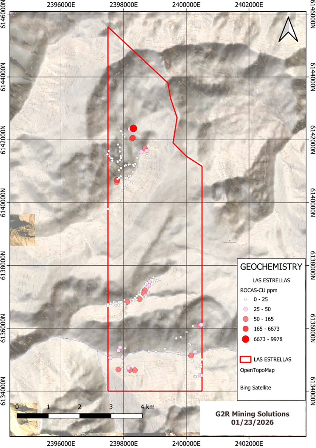
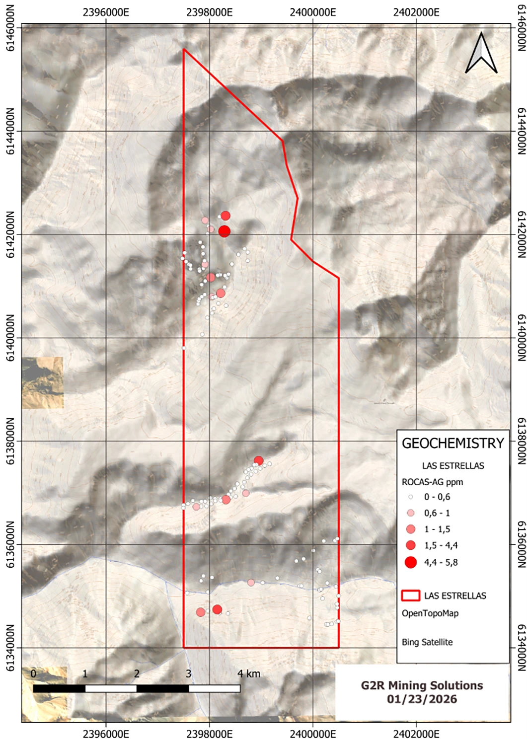
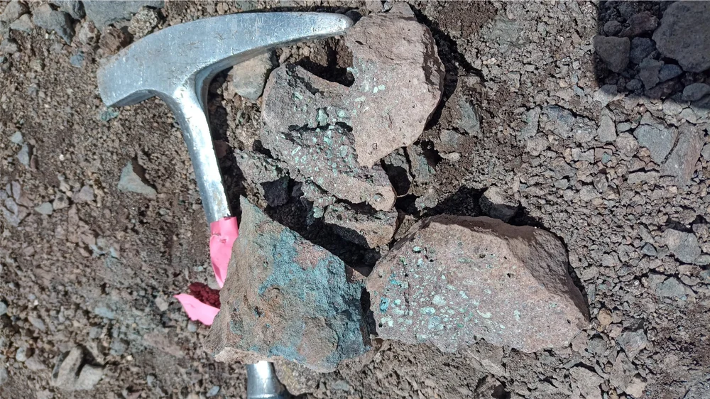
All Projects

Las Estrellas

Argentina Metals' lead copper-gold project on the 146,728-hectare Western Malargüe land position. Surface geochemistry and a property-scale magnetometric survey have defined targets in two distinct zones.

Project Snapshot

Location Mendoza Province, Argentina
Commodities Copper (primary), gold, silver
Current Phase Phase 2: Target Definition
District Land Package 146,728 ha consolidated
Technical report Full geological summary, geochemistry tables and figures. Download PDF

Exploration

December 2025 field program

The initial exploration work carried out in Las Estrellas in December 2025 identified a large area occupied by volcanic rocks of andesitic-basaltic composition. Geological mapping, ground-based magnetometry and sampling were carried out throughout the property area.

The four highest-copper samples cluster in a single target zone in the northern sector of the property.

Threshold Value
Samples > 50 ppm Cu 17
Samples > 100 ppm Cu 5
Peak (G2R-287) 6,673 ppm Cu
Peak (G2R-271) 9,978 ppm Cu
Total samples collected 144 rock / 14 stream
Sample G2R-271 in gloved hands, peak 9,978 ppm Cu from the northern target zone at Las Estrellas
G2R-271 9,978 ppm Cu Northern target zone
Sample G2R-332 held up against the property sky, 326 ppm Cu
G2R-332 326 ppm Cu Anomalous halo
Large oxidised copper-bearing sample with orange pen for scale, collected at Las Estrellas
Bulk sample Oxidised Cu Pen for scale

Project maps

Surface geochemistry and ground magnetometry produced three property-scale plates that together frame the discovery case: copper and silver from rock chip sampling, alongside the magnetic signature of the underlying intrusive bodies.

Plates · January 2026

Property-scale copper anomaly map from the December 2025 rock chip program at Las Estrellas
Copper anomalies Rock chip / talus sample values across the property
Property-scale ground magnetometric signature map at Las Estrellas, January 2026 AMT survey
Magnetometric signature Reduced-to-pole intensity from the January 2026 AMT survey
Property-scale silver anomaly map from the December 2025 rock chip program at Las Estrellas
Silver anomalies Rock chip / talus sample values across the property

Conclusion

Two distinct interpretations emerge along the property: a mineralised target in the north, and the periphery of a porphyry system in the south.

Copper-mineralised rock outcrop with rock hammer for scale, Las Estrellas northern zone
Northern zone

El Burrero-style copper-silver mantle

In the northern part, there is a potential mineralized zone that would correspond to the El Burrero mine model: a volcanic mantle-type deposit of copper and silver, with some indications of a possible skarn or IOCG as well.

Altered yellow-orange slope at Las Estrellas, characteristic of the porphyry-margin alteration in the southern zone
Southern zone

Porphyry copper system periphery

In the southern part, geochemistry indicates a peripheral zone of a porphyry copper system: relatively high values of arsenic and lead, and low values of copper and molybdenum.